
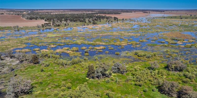
The rules proposed for the water sharing plan aim to improve protection for significant wetlands and apply to new or amended water supply works and trades in certain wetlands. This is to ensure that no further water supply demand is placed on those wetlands beyond current levels.
Since last November, hundreds of residents, landholders and stakeholder groups have shared their local knowledge and expertise and voiced concerns over anomalies in the maps of prescribed wetlands in the draft Gwydir, Namoi-Peel, Macquarie/Wambuul-Bogan, Lachlan, Murrumbidgee and Barwon-Darling unregulated water sharing plans.
“I want to thank the community for their insight and patience while we’ve been working tirelessly to get these wetland areas right.” said NSW DCCEEW Executive Director of Water Planning Giselle Howard.
“We want water sharing plans that work well for everyone, and it’s been heartening to see so many people engage with us throughout the process. We’ve heard from many locals on the ground, including farmers, landholders and stakeholders who have been very generous with their time and expertise.”
“Their feedback has been instrumental in helping us update the mapping, and we’re committed to continuing to engage with them over the next year so that everyone can be certain that only appropriate wetland sites are included.”
Last month, the NSW Government released revised maps and held an additional three-week consultation period inviting the community to give feedback on the updates, which has played a critical role in shaping the way they will manage the wetlands process.
In the finalised water sharing plans, which will come into effect by 1 July 2025, prescribed wetland areas will be limited to internationally significant Ramsar listed sites, areas registered in the Directory of Important Wetlands of Australia, and any wetlands already receiving protection in the current water sharing plans, as these are sites that are already formally recognised.
“These water sharing plans are vital for managing the regions’ water resources, and including wetland protections is a key part of safeguarding these unique and important environmental assets, and the animals, plants and ecosystems that rely on them.” said Howard.
“But we agree with locals that they need to be correct, which is why we’re continuing to work with the community to fine-tune the process and ensure only appropriate wetlands are included.”
Over the next 12 months, consultation will continue with landholders and the community on other wetlands identified in the revised maps to ensure they are getting these sites right.
The water sharing plans will then be amended before June 2026 to add wetlands from that group that have been looked at in close detail.
This approach will provide the community with confidence and peace of mind that prescribed wetland areas are accurate and appropriate.
“We will also be revisiting the wetland maps in 6 additional unregulated plans that came into effect in July 2024 with additional community consultation scheduled for the second half of 2025.”
These are the Intersecting Streams, Border Rivers, Castlereagh, Murray, Lower Murray Darling, and North Western unregulated water sharing plans.
All water sharing plans are independently audited after the first five years to ensure they are working effectively and appropriately.
For more information, visit the website here.
Don’t miss any of the important stories from around the region. Subscribe to our email list.