
Uralla Shire Council has received a $855,315 grant to develop a comprehensive 30-year water strategy funded under the Safe and Secure Water Program from the NSW Department of Energy, Climate Change, the Environment and Water (DECCEW).
The funds have enabled Council to commence several studies to identify major risks facing the long-term management of the region’s water supply and wastewater systems and develop options to improve reliability and sustainability.
“This is the sort of thing that you hope to confront once in your career because it’s the biggest professional challenge you ever get,” said Mr Mick Raby, Director of Infrastructure and Development at Uralla Shire Council.
“We don’t even know how big the challenge is yet. However, we have massive support from the State Government, through the Office of Water, DECCEW, the Department of Health and others to develop this Water Security Plan.”
In the 2019-20 drought, Uralla Shire experienced the driest period since rainfall records commenced in the late 1800s. Emergency Level 5 water restrictions were put in place in early January 2020, when dam capacity fell to 29 per cent, with an estimated 105 days until empty.
A Secure Yield Assessment had been conducted in 2015, indicating that demand should not exceed Kentucky Creek Dam supply in a dry year until 2044. In the light of the 2019 drought this reality came to pass 25 years sooner than predicted.
In response to the drought, local sustainability group ZNet Uralla, initiated the ‘Let’s Talk About Water’ project, which was funded through the NSW Government Increasing Resilience to Climate Change community grant program in collaboration with Uralla Shire Council and the University of NSW Global Water Institute.
“Our community and landholders gave feedback on what their values and opinions were on a series of options to improve water supply security, but at that stage we didn’t have any information on how much it would cost, whether it was technically feasible or what the most sensible thing was to do,” said Dr Sandra Eady of ZNet Uralla.
“We are now building on that initial community consultation with some up-to-date information, because in the ongoing investigation of where we’re going to get more water from and how much more we will need, it is really crucial to know how much water we’ve actually got.”
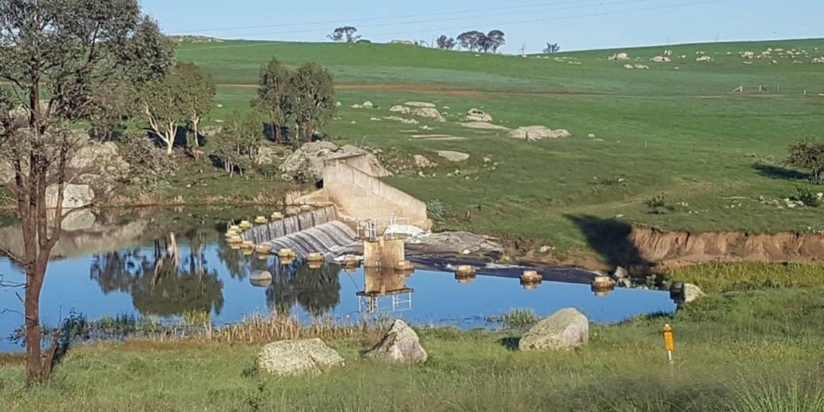
Kentucky Creek Dam, the water storge reservoir for the township of Uralla, was built in 1942 with the dam wall being raised in the 1980’s. Until now, water capacity was determined to be 500ML, based on measurements at these events. While Uralla Shire Council holds the title for the original surveyed area, the ground surrounding the dam is privately owned working land.
Z-NET proposed an Honours project with UNSW.
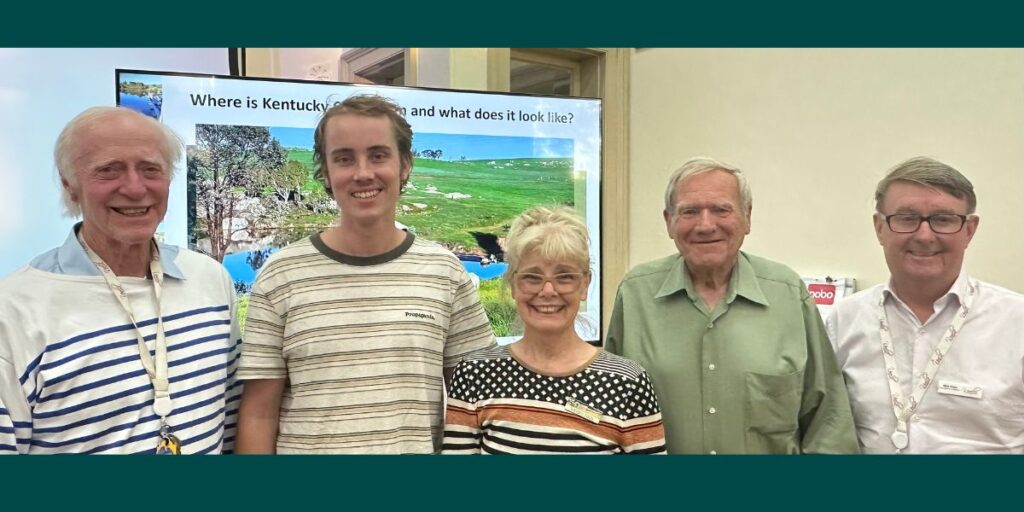
In 2024 Engineering Surveying Honours student, Jarvis Mumford-Day, undertook a comprehensive sonar mapping of Kentucky Creek Dam to understand the extent of siltation and how this has affected water storage capacity for the township of Uralla. Mr Mumford-Day presented his findings to a well-attended public meeting in Uralla on Monday 20th January.
“At my initial site visit at the start of 2024, I undertook some preliminary testing using a UAV (drone) to map the terrain surrounding the reservoir and measured the topology of the reservoir floor,” said Mr Mumford-Day.
“What became a large part of my thesis was developing the technology to be able to measure the depth of the sediment throughout the reservoir in the form of a modified ‘sounding pole’.”
Mumford-Day traversed the dam extensively by boat for several days on numerous occasions with his modified device to measure the depth of sediment build-up across the reservoir floor. The comprehensive dataset was then computer-modelled to reveal some surprising results.
“I found that there was about 150 megalitres of sediment built up across the reservoir floor since it was first built, which equates to about 30 per cent of design capacity. In general, the sediment was pretty consistent at around two meters depth, however reached about 5 to 6 meters at some points,” said Mr Mumford-Day.
“With the actual capacity of the reservoir about 30 per cent less than the design volume, where Council’s model of water levels based on original dam capacity indicated 29 per cent and 105 days available during the peak of the drought, my model estimates there was closer to just 15 or 16 per cent capacity, around 16 days, which is significantly lower than believed.”
Mr Mumford-Day also investigated changes to the surface area if the dam wall was raised.
“The current surface area is around 18 hectares. If you were to raise the dam wall by one-meter the surface area would increase to around 30 hectares with a 60 per cent volume increase, providing around 123 days additional supply.”
“A two-meter height increase would increase the surface area to around 43 hectares, and while this provides significant increase to capacity, it also floods a lot of the privately-owned agricultural land and access roads.”
This research provides an invaluable fact-based dataset which will aid Uralla Shire Council in managing their water security. In the immediate term, knowing the revised capacity will allow for recalibration of trigger points to implement water restrictions. It also provides base-level information from which Uralla Shire Council can develop their Water Security Plan for sustainability into the future.
“This body of work is happening in a very broad context,” said Mr Raby.
“The work done here with ZNet has highlighted the first problem, which is to define what water security is for Uralla.”
“For the Uralla community, growth has been moderate and steady over the past 20 years. Then, over the top of that comes the Renewable Energy Zone which is going to have a minimum 10-year impact across the 10 projects within our Shire both in terms of population growth and decline and construction phases.”
“Ultimately, water security isn’t just about increasing the size of the dam. It’s about understanding usage projections, how usage can be minimised, and how resilient the source and or potential future sources are.”
“We are grappling with a very new and unknown set of circumstances. We’re targeted to finish our Water Security Plan by December this year, but we hope to have many more community discussions during this time because the solution needs to be community driven.”
“Council cannot dictate this process as the result will impact everybody and has the potential to change the way we live, said Mr Raby.
Something going on in your part of the region you think people should know about? Send us a news tip or email newsdesk@netimes.com.au.